Saturday, June 26, 2010

Ujung Kulon National Park

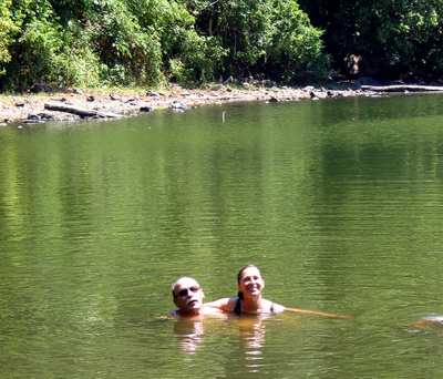
Ujung Kulon National Park is located at the western-most tip of Java, Banten, Indonesia. It includes the volcanic island group of Krakatoa and other islands including Panaitan, Handeuleum and Peucang. The park encompasses an area of 1,206 km² (443 km² marine), most of which lies on a peninsula reaching into the Indian Ocean. The explosion of nearby Krakatau in 1883 produced a tsunami (giant wave) that eliminated the villages and crops of the coastal areas on the western peninsula, and covered the entire area in a layer of ash about 30 cm thick. This caused the total evacuation of the peninsula by humans, thereby allowing it to become a repository for much of Java’s flora and fauna, and most of the remaining lowland forest on the island.

Javan Rhinoceros
It is Indonesia's first proposed national park and was declared a UNESCO World Heritage Site in 1991 for containing the largest remaining lowland rainforest in Java. It is also one of only two homes of the critically endangered Javan Rhinoceros. A population of fifty to sixty live in Ujung Kulon, a smaller population of possibly 10 or less, live in Cat Tien National Park, Vietnam. The park protects 57 rare species of plant. The 35 species of mammal include Banteng, Silvery Gibbon, Javan Lutung, Crab-eating Macaque, Leopard, Java Mouse-deer and Rusa Deer. There are also 72 species of reptiles and amphibians, and 240 species of birds.
Parts of today's national park and World Heritage site have been protected since the early 20th century. Karakatoa Island was declared a Nature Reserve in 1921, followed by Pulau Panaitan and Pulau Peucang Nature Reserve in 1937. The Ujung Kulon Nature Reserve has been established in 1958 followed by the Gunung Honje Nature Reserve in 1967. Ujung Kulon National Park has been established in 1992. In 2005 the park has been designated as an ASEAN Heritage Park. [source : Ujung Kulon]

See The Beauty


Tana Toraja

The Toraja are an ethnic group indigenous to a mountainous region of South Sulawesi, Indonesia. Their population is approximately 650,000, of which 450,000 still live in the regency of Tana Toraja ("Land of Toraja"). Most of the population is Christian, and others are Muslim or have local animist beliefs known as aluk ("the way"). The Indonesian government has recognized this animist belief as Aluk To Dolo ("Way of the Ancestors").

Torajan Graves
The word Toraja comes from the Bugis language's to riaja, meaning "people of the uplands". The Dutch colonial government named the people Toraja in 1909. Torajans are renowned for their elaborate funeral rites, burial sites carved into rocky cliffs, massive peaked-roof traditional houses known as tongkonan, and colorful wood carvings. Toraja funeral rites are important social events, usually attended by hundreds of people and lasting for several days.
Torajan Baby Graves

Before the 20th century, Torajans lived in autonomous villages, where they practised animism and were relatively untouched by the outside world. In the early 1900s, Dutch missionaries first worked to convert Torajan highlanders to Christianity. When the Tana Toraja regency was further opened to the outside world in the 1970s, it became an icon of tourism in Indonesia: it was exploited by tourism developers and studied by anthropologists. By the 1990s, when tourism peaked, Toraja society had changed significantly, from an agrarian model — in which social life and customs were outgrowths of the Aluk To Dolo—to a largely Christian society. [source : Tana Toraja]

See The Beauty

Torajan Villages

Toraja Rice-field
Toraja Funeral Rites

Toraja Traditional House

Thursday, June 17, 2010

White Sand Beaches of Karimunjawa Islands

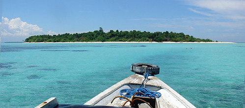
Karimunjawa is an island chain stretching in a northwesterly direction 83 km from Jepara. Central Java. This archipelago is a cluster of 27 islands in the java sea. Only seven of the islands are inhabited. The reefs are a mixture of fringing, barrier, and patch with bottom depths ranging from 15 to 40 meters. 

The name of Karimunjawa is taken from Javanese language 'Kremun kremun saking tanah Jawi' addressed by one of Wali Songo (the Nine Saints who had introduced Islam in Java) to describe how far this mini archipelago from Java, to be exact from Semarang and Jepara. Stands from 27 islands, this mini archipelago became marine national park and it's like a treasure for those who love marine life. Here can be found protected coral reefs (very colorful plateaus and plains in deep and shallow waters), secluded and tranquil white beaches, pelican and hornbill, sea grass and kinds of sea creatures, from crabs, anchovy, starfish, sharks, stingray, jellyfish, red snappers, etc.

The Marine National Park Karimun Jawa is 110,000 ha and lies 90 km north east of Jepara in Central Java. We will find mangrove forest and beach forest. The park is named after the largest island Karimun Jawa. The vegetation consists mainly of mangrove and beach forest, although there is some lowland rain forest on Karimun Jawa. Most of the islands are surrounded by sandy beaches and fringing coral reefs. Fresh water is confined to a few small wells and forest streams on Karimun Jawa. A number of endemic animals live on the island while on the beaches sea turtles lay their eggs. The average tidal range is 92 cm.

The archipelagic Karimunjawa, thought not as known the Marine reserves near Ambon and Manado, has unexpectedly good beaches, reefs and lovely sea scopes. Corals seem to blossom in to gardens, with an Amazing variety of form and color fishers and marine plants. It lies 90 km away from Jepara and can reached by "KM. Adison I & KM Kota Ukir" boat, the only ferryboat connecting Karimunjawa and Jepara. The resort offers stunning dives and snorkeling trips for all sorts of divers from novice to experience. Fringing reefs, atolls, wrecks and an excellent variety of different species make diving in Karimunjawa an unforgettable adventure. [source : Karimunjawa]

See The Beauty

Saturday, June 12, 2010

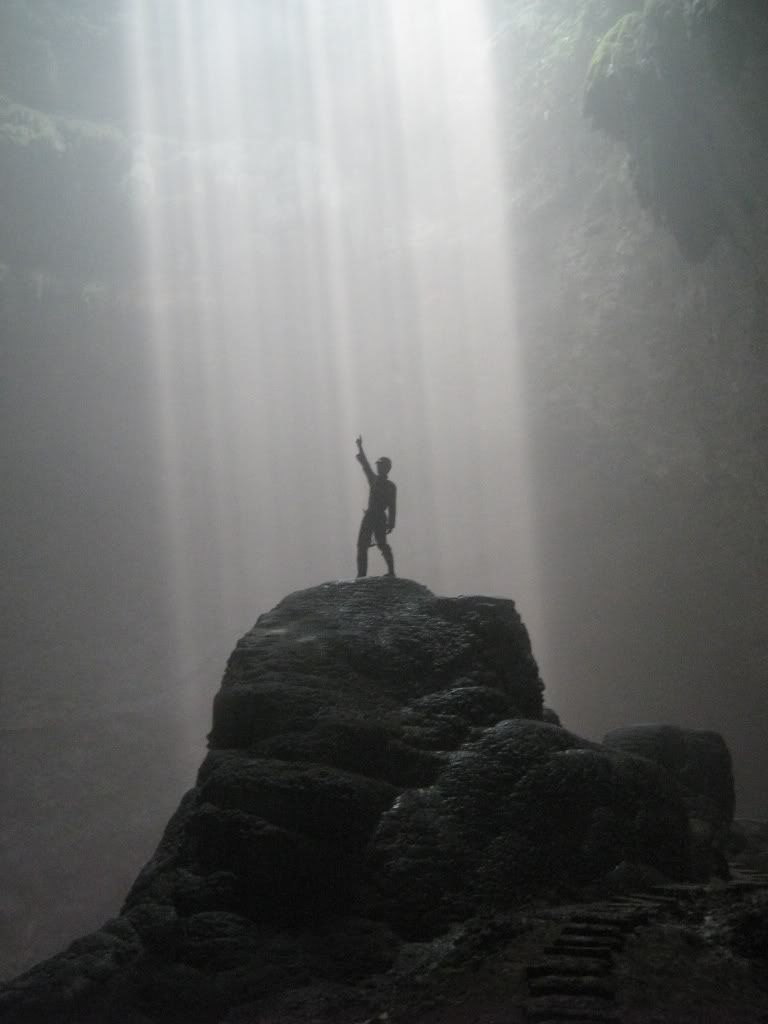
Jomblang-Grubug Cave

Jomblang-Grubug Cave is located in Jetis village, sub-district Semanu, district Gunungkidul or approximately 50 kilometers Yogyakarta's south east. This cave is a part of 500 caves in Gunungkidul karst mountains.


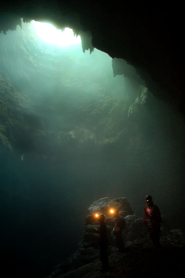
Jomblang-Grubug cave is a vertical cave with 70-80 meters deeps. That's why it needs Single Rope Technique (SRT) to enter the cave. This technique makes descending and ascending movement safely.

In the cave we will found a stunning views such as pre-historical forest, aven (light hole), beautiful stalactite and stalagmite, under ground rivers, and underground waterfall.

See The Beauty

Bawean Island

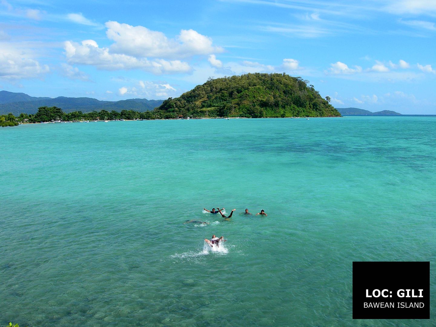
Bawean is an island of Indonesia located approximately 150 km north of Surabaya in the Java Sea, it is administered by Gresik Regency of East Java province. It is approximately 15 km in diameter and is circumnavigated by a single narrow road. Bawean is dominated by an extinct volcano at its center that rises over 650 m above sea level. The island's population is around 65,000. Approximately 40,000 live in the capital of Sangkapura and the rest live in small villages scattered around the island.

The name of the island comes from a Sanskrit name which means "there is sunlight". In Indonesian, it is known in full as Pulau Bawean (Bawean Island). In Singapore and Malaysia, where many Baweanese migrated, the island is known as Boyan and its natives as Boyanese. Bawean is also called the "Island of Women" because of the large number of men that become merchant sailors and leave the island.
Topographically, the island rises to a point at the volcano near the center and descends through lush jungle to white-sand beaches, tidepools, and mangrove stands. Like many islands in Southeast Asia, Bawean is surrounded by several coral reefs and multiple sand islands (noko).

Although the distance around this small island is approximately only 70 kilometres, Bawean has quite a number of attractions such as Pante Ria Beach, Kastoba Lake, Laccar Waterfall, Kasta Tinggi Waterfall, Bawean Deer, Lalajer Island, and many more. [source : Bawean

See The Beauty


Monday, June 7, 2010

Borobudur

Borobudur, or Barabudur, is a ninth-century Mahayana Buddhist monument near Magelang, Central Java, Indonesia. The monument comprises six square platforms topped by three circular platforms, and is decorated with 2,672 relief panels and 504 Buddha statues. A main dome, located at the center of the top platform, is surrounded by 72 Buddha statues seated inside perforated stupa.

Relief in Borobudur
The monument is both a shrine to the Lord Buddha and a place for Buddhist pilgrimage. The journey for pilgrims begins at the base of the monument and follows a path circumambulating the monument while ascending to the top through the three levels of Buddhist cosmology, namely Kāmadhātu (the world of desire), Rupadhatu (the world of forms) and Arupadhatu (the world of formlessness). During the journey the monument guides the pilgrims through a system of stairways and corridors with 1,460 narrative relief panels on the wall and the balustrades

Evidence suggests Borobudur was abandoned following the fourteenth century decline of Buddhist and Hindu kingdoms in Java, and the Javanese conversion to Islam. Worldwide knowledge of its existence was sparked in 1814 by Sir Thomas Stamford Raffles, the then British ruler of Java, who was advised of its location by native Indonesians. Borobudur has since been preserved through several restorations. The largest restoration project was undertaken between 1975 and 1982 by the Indonesian government and UNESCO, following which the monument was listed as a UNESCO World Heritage Site. Borobudur is still used for pilgrimage; once a year Buddhists in Indonesia celebrate Vesak (Indonesian: Waisak) at the monument, and Borobudur is Indonesia's single most visited tourist attraction. [source: http://en.wikipedia.org/wiki/Borobudur]
See The Beauty
Borobudur Aerial View
Borobudur Night View
Merapi Volcano as Background
Sunrise at Borobudur

Saturday, June 5, 2010

Rote Island

Rote Island (Indonesian: Pulau Rote, also spelled Roti) is an island of Indonesia, part of the East Nusa Tenggara province of the Lesser Sunda Islands. It has an area of 1,200 km2 (463 sq mi). It lies 500 km (311 mi) northeast of the Australian coast and 170 km (106 mi) northeast of the Ashmore and Cartier Islands. The island is situated to the southwest of the larger island of Timor. To the north is the Savu Sea, and to the south is the Timor Sea. To the west is Savu and Sumba. The uninhabited Dana Island (also called Ndana), just south of Rote, with an area of 14 km2 (5 sq mi), is the southernmost island of Indonesia. Along with some other nearby small islands, such as Ndao, it forms the kabupaten (regency) of Roti Ndao, which in 2005 held an estimated population of 108,615.

The main town, called Baa, is located in the north of the island. It has a good surf area in the south around the village of Nembralla. There is a daily ferry to the island from Kupang, the provincial capital on West Timor, which brings tourists.

Sasando
Rote has many historical relies including fine antique Chinese porcelain, as well as ancient arts and traditions. Many prominent Indonesia nationalist leaders were born here. A popular music instrument Sasando, which is made of palm leaves. According to legend, this island got its name accidentally when a lost Portuguese sailor arrived and asked a farmer where he was. The surprised farmer, who could not speak Portuguese, introduced himself, "Rote".

Rote just off the southern tip of Timor Island consists of rolling hills, terraced plantations, and acacia palm, savanna and some forests. The Rotinese depend, like the Savunese, on lontar palm for basic survival, but also as the supplement their income with fishing and jewelry making.


See The Beauty

Rote Island : Aerial View
Surf at Rote
Feel Rote's White Sands
Sunset at Rote

Thursday, June 3, 2010

Pangandaran Beach

Pangandaran is a small town and a subdistrict in southern Ciamis regency, West Java, Indonesia. It is located on the southern coast of Java. Pangandaran is a popular tourist destination, having a beach which is considered to be one of the finest in Java and which offers excellent surfing.

A kite-flying festival is held on the beach in July each year. Locals regularly use kites in the evenings to catch bats,which are either eaten or used in Chinese remedies. There is a local belief that wearing any green garment in this area will anger Loro Kidul, the Javanese guardian spirit or goddess of the southern sea, and will bring misfortune.

The Penanjung Pangandaran nature reserve is nearby on a peninsula connected to the mainland by a narrow neck of land. About eighty percent of the nature reserve is secondary rainforest. The flora of the nature reserve includes the Rafflesia.


See The Beauty