Monday, May 31, 2010

Lake Toba : the largest volcanic lake in the world

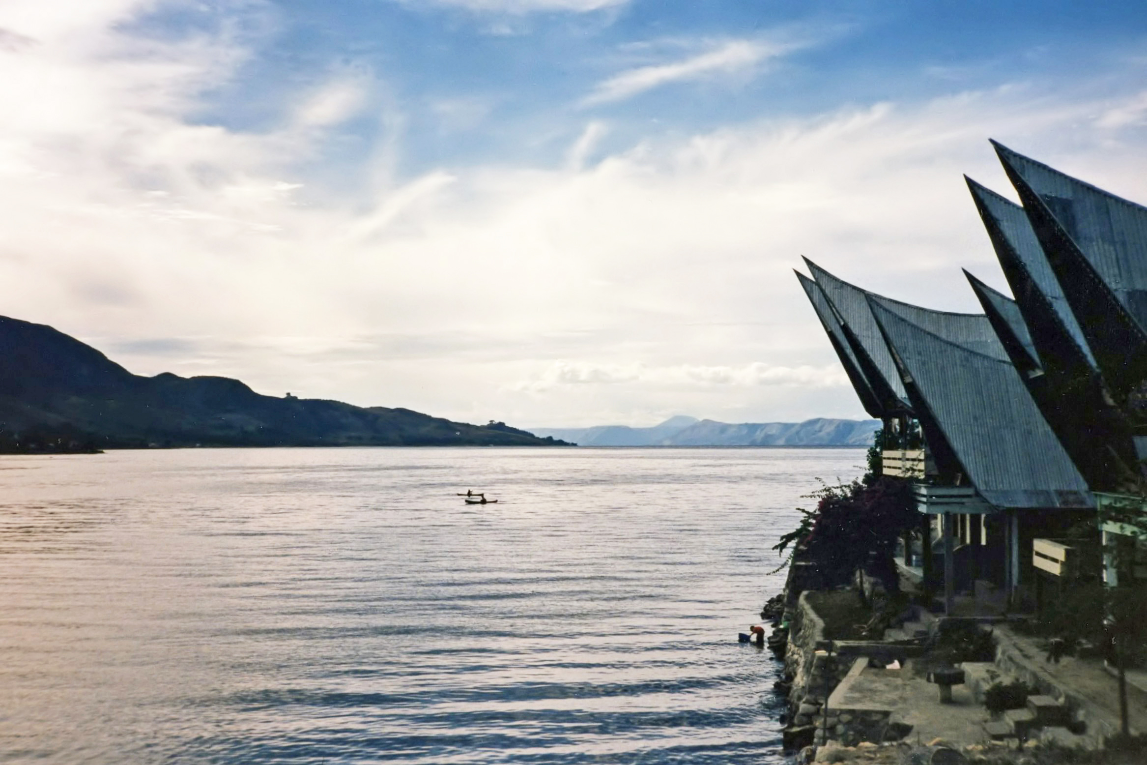
Lake Toba (Indonesian: Danau Toba) is a lake and supervolcano, 100 kilometres long and 30 kilometres wide, and 505 metres (1,666 ft) at its deepest point. Located in the middle of the northern part of the Indonesian island of Sumatra with a surface elevation of about 900 metres (2,953 ft). It is the largest volcanic lake in the world.

Lake Toba is an immense volcanic lake covering an area of 1707 sq km (bigger than Singapore) with an island in the center. Formed by a gigantic volcanic eruption some 70,000 years ago, it is probably the largest resurgent caldera on Earth. Some studies say it might have been associated with causing previous ice age/climate change and the largest human population bottleneck ever. Genetic estimates suggests that there where only a few thousand individuals that survived the catastrophe. The island in the middle - Pulau Samosir - was joined to the caldera wall by a narrow isthmus, which was cut through to enable boats to pass; a road bridge crosses the cutting. Samosir island is the cultural centre of Batak tribe.
Lake Toba is a beautiful and unique place to visit in Indonesia. It is just a few hours drive from Indonesia’s third largest city Medan. Medan has flights from Kuala Lumpur, Penang, Jakarta and Singapore and many other cities in Indonesia.

There is so many tourism attractions around Lake Toba :

Tuk Tuk
Tuk Tuk is the main tourist center on Samosir Island. It is a pleasant place for walking around, shopping and admiring the views over Lake Toba.
Tomok
Tomok is about 5km from Tuk Tuk on Samosir Island. It is the main area that locals live. It is a good place for buying souvenirs and eating local food. In Tomok you can see the grave of King Sidabutur. He was the Batak King that introduced Christianity to the Batak people.
Ambarita
Ambarita is famous for the “stone chairs”. The stone chairs are around 300 years old where a kind of court was held to decide the fate of criminals. Serious crimes were dealt with harshly. The criminals were beaten and their bodies rubbed with lemon and chilli to make their wounds more painful and finally they were beheaded and their bodies thrown into Lake Toba.
Blood and some meat of the criminal was eaten by the king and the villagers. One of the guides is a direct descendant of the former king of the village.
Museum Huta Solon Simanindo
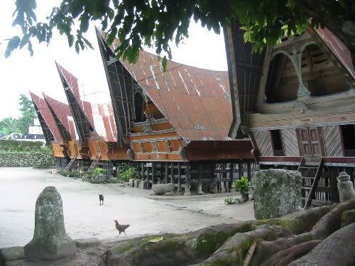
A visit to the museum is a must for anyone wanting to explore Batak culture and tradition. There are some good examples of traditional Batak houses. There are Batak dancing performances held from Monday to Saturday at 10:30 am. Audience participation is more than welcome!
Hot springs
The hot springs located around 40km from Tuk Tuk and is a scenic drive to get there. The water from the hot springs is not surprisingly very hot!
Swimming in Lake Toba
Lake Toba is great for swimming and cooling off. The water is a little chilly but as they say, it’s fine once you get in. The water is deep, but a few hotels have created their own swimming areas in the lake to make it safe for people with young children.
 
for detailed info visit http://www.laketoba.info/

See The Beauty

Wide Open View
Aerial View
Traditional House Design

Sunday, May 30, 2010

Banda Islands

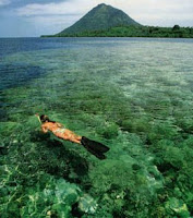
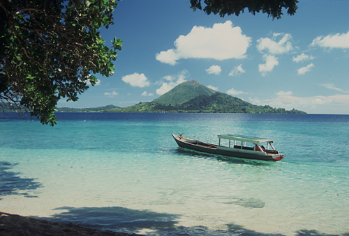
The Banda Islands (Indonesian: Kepulauan Banda) are a volcanic group of ten small volcanic islands in the Banda Sea, about 140 km south of Seram island and about 2000 km east of Java, and are part of the Indonesian province of Maluku. The main town and administrative centre is Bandanaira, located on the island of the same name. They rise out of 4–6 km deep ocean and have a total land area of approximately 180 km2. They have a population of about 15,000. Until the mid 19th century the Banda Islands were the world's only source of the spices nutmeg and mace, produced from the nutmeg tree. The islands are also popular destinations for scuba diving and snorkeling.

Seemingly insignificant islands in the middle of nowhere in the Banda Sea, in fact the Banda Islands are steeped in history and blessed with some of the finest diving in the country. Central to the spice trade of old, and former home to exiled freedom fighters, the islands are now enjoying a growing reputation for what goes on below the surface.

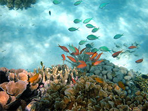
The remoteness of the islands in the wide open Banda Sea, and the low levels of human population, have meant less fishing pressures, and a vibrant, natural and healthy reef system. The results of this are fishes in incredible numbers, huge seafans and sponges, and some monumental hard corals. 

Some of the creatures worthy of special mention here that characterise diving in the Banda Sea are the preponderance of dogtooth tuna and mobula rays. At most sites you'll see enormous schools of fusiliers and thousands of redtooth tirggerfish. At the other end of the size scale, there are prolific mandarinfish and the native Ambon scorpionfish. Cetaceans are frequent visitors too, and Banda liveaboards often report sightings of spinner dolphins, orcas, and various whale species, including melonhead, pilot, blue, and humpback whales. One certainty is that you will see plenty of big stuff as well as no shortage of colourful reef life.

Topside, these islands boast climbable volcanic mountains which are covered in lush green vegetation. For a taste of historic atmosphere going ashore in Banda Neira is a must for its remnants from the old spice trade of colonial times.  


See The Beauty


Bunaken National Marine Park : A Paradise Under The Sea

The Bunaken National Marine Park was formally established in 1991 and is among the first of Indonesia's growing system of marine parks. The park covers a total surface area of 89,065 hectares, 97% of which is overlain by sparkling clear, warm tropical water. The remaining 3% of the park is terrestrial, including the five islands of Bunaken, Manado Tua, Mantehage, Nain and Siladen. Although each of these islands has a special character, it is the aquatic ecosystem that attracts most naturalists.

The waters of Bunaken National Marine Park are extremely deep (1566 m in Manado Bay), clear (up to 35-40 m visibility), refreshing in temperature (27-29 C) and harbor some of the highest levels of biodiversity in the world. Pick any of group of interest - corals, fish, echinoderms or sponges - and the number of families, genera or species is bound to be astonishingly high. For example, 7 of the 8 species of giant clams that occur in the world, occur in Bunaken. The park has around 70 genera of corals; compare this to a mere 10 in Hawaii. Although the exact number of fish species is unknown, it may be slightly higher than in the Philippines, where 2,500 species, or nearly 70% of all fish species known to the Indo-western Pacific, are found.

Oceanic currents may explain, in part, why Bunaken National Marine Park is such a treasure trove of biodiversity. Northeasternly currents generally sweep through the park but abundant counter currents and gyros related to lunar cycles are believed to be a trap for free swimming larvae. This is particularly true on the south side of the crescent-shaped Bunaken Island, lying in the heart of the park. A snorkler or diver in the vicinity of Lekuan or Fukui may spot over 33 species of butterfly fish and numerous types of groupers, damsels, wrasses and gobies. The gobies, smallish fish with bulging eyes and modified fins that allow them to attach to hard surfaces, are the most diverse but least known group of fish in the park.

Biologists believe that the abundance of hard corals is crucial in maintaining the high levels of diversity in the park. Hard corals are the architects of the reefs, without them, numerous marine organisms would be homeless and hungry. Many species of fish are closely associated with particular types of corals (folious, branching, massives, etc.) for shelter and egg-laying. Others, like the enormous Bumphead Parrotfish, Balbometopon muricatum, are "coralivores" and depend on hard corals for their sustenance. Bony mouth parts fused into an impressive "beak" allow these gregarious fish to crunch corals like roasted peanuts.

Some 20,000 people live on the natural resources of Bunaken National Marine Park. Although there are inevitable conflicts between resource protection and use by people, the Indonesian government is taking a fairly unusual and pragmatic approach to park management. The idea is to promote wise resource use while preventing overexploitation. Local communities, government officials, dive resort operators, local nature groups, tourists and scientists have played an active role in developing exclusive zones for diving, wood collection, fishing and other forms of utilization. Bunaken Marine Park has become an important example of how Sulawesi, and the rest of Indonesia, can work to protect its natural resources.


See The Beauty


Saturday, May 29, 2010

Komodo Island

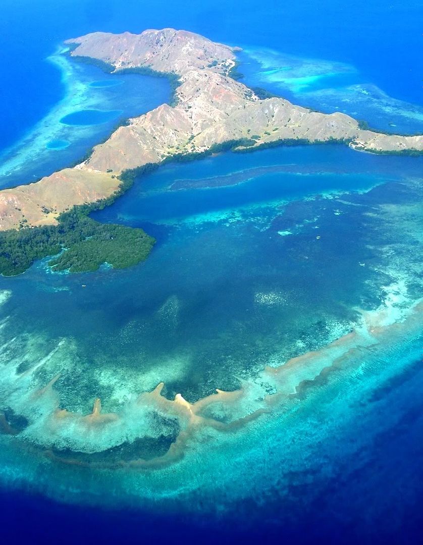
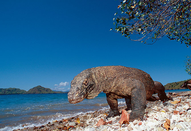
Komodo National Park is located in the center of the Indonesian archipelago, between the islands of Sumbawa and Flores. Established in 1980, initially the main purpose of the Park was to conserve the unique Komodo dragon (Varanus Komodoensis) and its habitat. However, over the years, the goals for the Park have expanded to protecting its entire biodiversity, both terrestrial and marine. In 1986, the Park was declared a World Heritage Site and a Man and Biosphere Reserve by UNESCO, both indications of the Park's biological importance.

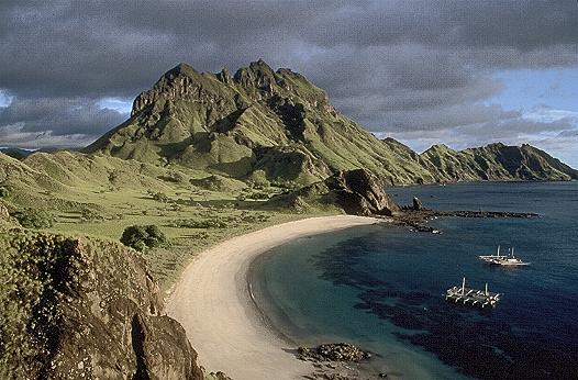
Komodo National Park includes three major islands: Komodo, Rinca and Padar, as well as numerous smaller islands creating a total surface area (marine and land) of 1817km (proposed extensions would bring the total surface area up to 2,321km2). As well as being home to the Komodo dragon, the Park provides refuge for many other  notable terrestrial species such as the orange-footed scrub fowl, an endemic rat, and the Timor deer. Moreover, the Park includes one of the richest marine environments including coral reefs, mangroves, seagrass beds, seamounts, and semi-enclosed bays. These habitats harbor more than 1,000 species of fish, some 260 species of reef-building coral, and 70 species of sponges. Dugong, sharks, manta rays, at least 14 species of whales, dolphins, and sea turtles also make Komodo National Park their home.

Threats to terrestrial biodiversity include the increasing pressure on forest cover and water resources as the local human population has increased 800% over the past 60 years. In addition, the Timor deer population, the preferred prey source for the endangered Komodo dragon, is still being poached. Destructive fishing practices such as dynamite-, cyanide, and compressor fishing severely threaten the Park's marine resources by destroying both the habitat (coral reefs) and the resource itself (fish and invertebrate stocks). The present situation in the Park is characterized by reduced but continuing destructive fishing practices primarily by immigrant fishers, and high pressure on demersal stocks like lobsters, shellfish, groupers and napoleon wrasse. Pollution inputs, ranging from raw sewage to chemicals, are increasing and may pose a major threat in the future.

for further information visit http://www.komodonationalpark.org/

See The Beauty


Wednesday, May 26, 2010

Suramadu Bridge : The Longest Bridge in Indonesia

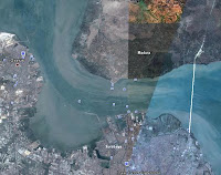
The Suramadu Bridge (Indonesian: Jembatan Suramadu), also known as the Surabaya–Madura Bridge, is a bridge with three cable-stayed sections constructed between Surabaya on the island of Java and the town of Bangkalan on the island of Madura in Indonesia. Opened on June 10, 2009, the bridge with length 5,438 metres (17,841 ft), width 30 metres (98 ft), and height 146 metres (479 ft) is the longest in Indonesia and the first bridge to cross the Madura Strait.

Construction was started on August 20, 2003. In July 2004, a girder collapsed, killing one worker and injuring nine others. Work on the bridge halted at the end of 2004 due to lack of funds, but was restarted in November 2005. The main span of the bridge was connected on March 31, 2009, and the bridge was opened to the public in June 10, 2009. Within a week of the opening, it was discovered that nuts and bolts as well as maintenance lamps had been stolen and that there was evidence of vandalism of cables supporting the main span.

The cable-stayed portion has three spans with lengths 192 m, 434 m and 192 m. The bridge has two lanes in each direction plus an emergency lane and a dedicated lane for motorcycles. The first toll bridge in Indonesia, fares have been initially set at Rp. 30,000 (US$3 in 2009) for four-wheeled vehicles and Rp. 3,000 (US$0.30) for two-wheelers.

The bridge was built by a consortium of Indonesian companies PT Adhi Karya and PT Waskita Karya working with China Road and Bridge Corp. and China Harbor Engineering Co. Ltd. The total cost of the project, including connecting roads, has been estimated at 4.5 trillion rupiah (US$445 million).

               http://www.suramadu.com/

 See The Beauty


Tuesday, May 25, 2010

Meru Betiri National Park

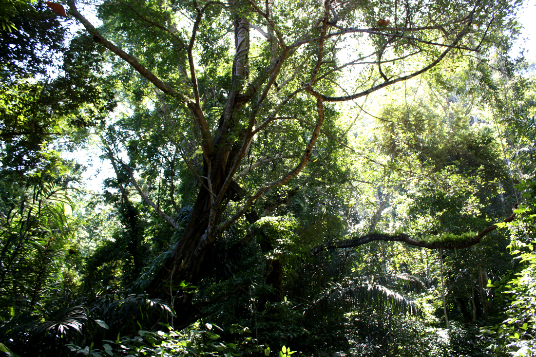
Meru Betiri National Park is a national park in the province of East Java, Indonesia, extending over an area of 580 km² of which a small part is marine (8.45 km²). The beaches of the park provide nesting ground for the endangered Leatherback turtles, Hawksbill turtles, Green turtles, and Olive Ridley turtles.

Meru Betiri National Park has a varied topography reaching from a plain coast to highlands with an altitude of almost 1,200 meters. The tallest mountains within the park are Mount Gamping (538 m), Mount Butak (609 m), Mount Sukamade Atas (801 m), Mount Gendong (840 m asl), Mount Mandilis (844 m) and Mount Betiri (1,192 m). The topography along the coast is generally hilly to mountainous. There are only few sandy plain coasts, most of them located in the west, such as Rajegwesi Beach, Sukamade Beach, Permisan Beach, Meru Beach and Bandealit Beach. Some rivers across Meru Betiri NP are Sukamade River, a perennial river, Permisan River, Meru River and Sekar Pisang River that flow to the South coast.

This national park is the habitat of rare plants, namely the interest Raflesia (Rafflesia zollingeriana), and several other types of plants such as Mangroves (Rhizophora sp.), Fire-fire (Avicennia sp.) Waru (Hibiscus tiliaceus), Nyamplung (Calophyllum inophyllum), Rengas (Gluta renghas), Bungur (Lagerstroemia speciosa), Pulai (Alstonia scholaris), Bendo (Artocarpus elasticus), and several species of plant medicines.

In addition, the Meru Betiri National Park have the potential to protected wildlife which consists of 29 species of mammals, and 180 species of birds. They are neat animals (Bos javanicus javanicus), long-tailed monkey (Macaca fascicularis), spotted tiger (Panthera pardus weld), ajag (Cuon alpinus javanicus), wildcat (Prionailurus bengalensis javanensis), deer (Cervus timorensis russa), flying squirrel red-tail (Iomys horsfieldii), peacock (Pavo muticus), starfruit turtles (Dermochelys coriacea), turtle shell (Eretmochelys imbricata), the green turtle (Chelonia mydas), and turtle ridel / fission (Lepidochelys olivacea). 

Meru Betiri National Park known as a habitat for Javanese Tigers (Panthera Tigris sondaica) a rare and protected. Until now, these animals never be found again and is estimated to have been extinct. Extinction of tigers loreng Java means extinction of three species of tigers from eight species in the world (in Iran's Caspian tiger, Bali tiger and Javan tiger in Indonesia).

Some interesting locations to be visited in Meru Betiri among other Rajegwesi Beach. At the beach, you can do nautical tourism, swimming, observation of plants or animals and cultural tourism (traditional fishermen). In the meadow Sumbersari, can be seen various animals such as sambar, deer, deer. Sukamade beaches suitable for camping activities, wind surfing, and observation of flora and fauna, particularly the activities that are laying turtles. The forest exploration, nautical tourism, and swimming can be done in Green Bay. 

The Meru Betiri area is influenced by monsoon wind. During November to March, the westerly wind brings rainfall to the area, whereas the dry season occurs during April to October. The average annual rainfall is between 2,300 and 4,000 mm, with 4 dry months and 7 wet months in average. And the best season  for visits this beuatiful place is among February to July each year.


See The Beauty


Friday, May 21, 2010

Mount Rinjani

Mount Rinjani or Gunung Rinjani is an active volcano in Indonesia on the island of Lombok West Nusa Tenggara (NTB). It rises to 3,726 metres (12,224 ft), making it the second highest volcano in Indonesia, and similar in height to Mount Fuji.

The first historical eruption occurred in September 1847. The most recent eruption of Mount Rinjani was in May 2010 and the most recent significant eruptions occurred during a spate of activity from 1994 to 1995 which resulted in the further development of Gunung Barujari. (G.Baru). Historical eruptions at Rinjani dating back to 1847 have been restricted to Barujari cone and the Rombongan dome (in 1944) and consist of moderate explosive activity and occasional lava flows that have entered Segara Anak lake. The eruptive history of Rinjani prior to 1847 is not available as the island of Lombok is in a location that remained very remote to the record keeping of the era.

The 6 km by 8.5 km oval-shaped caldera is filled partially by the crater lake known as Segara Anak ('Child of the Sea') This lake is approximately 2000 metres above sea level and estimated at being around 200 metres deep; the caldera also contains hot springs.

The Rinjani caldera forming eruption is thought to have occurred in the 13th century. Eruption rate, eruption sites, eruptiion type and magma composition have changed during the last 10,000 years before the caldera forming eruption. The eruptions of 1994 and 1995 have presented at Gunung Baru (or 'New Mountain' - approximately 2300 metres above sea level) in the center of this caldera and lava flows from subsequent eruptions have entered the lake. This cone has since been renamed Mount Barujari (or 'New Finger Mountain').

The highlands are forest clad and mostly undeveloped. The lowlands are highly cultivated. Rice, soybeans, coffee, tobacco, cotton, cinnamon, cacao, cloves, cassava, corn, coconuts, copra, bananas and vanilla are the major crops grown in the fertile soils of the island. The slopes are populated by the indigenous Sasak population. There are also some basic tourist related activities established on Rinjani primarily in or about the village of Senaru.

The volcano and the caldera are protected by the Gunung Rinjani National Park established in 1997. Tourism is increasingly popular with trekkers able to visit the rim, make their way into the caldera or even to make the more arduous climb to the highest point; fatalities, however, are not uncommon. In July 2009 the summit route was closed due to volcanic activity at that time and subsequently reopened when the activity decreased.

The lower and mid levels of the mountain are quite heavily forested. Above the tree line though the slopes are barren and rugged scree slopes and volcanic rock. The views of the crater lake are quite breath-taking from the caldera rim, as is the sunrise. From the absolute peak you can see Bali to the west and Sumbawa to the east.

The lower and middle elevation slopes are densely forested with typical tropical species. Fig trees are especially apparent. Casuarina forest (cemara) takes over higher up and eventually these give way to an alpine flora above the treeline.

Lombok is east of the Wallacean Line and some Australian bird species are therefore apparent. These include a lot of Sulphur Crested Cockatoos and Green Hanging Parrots. Bird life is generally not easy to observe here though due to the density of the forest.

The familiar long-tailed grey macaque (the Bali temple monkey!) is common right up to the crater rim. Of much more interest is the rare ebony leaf monkey which inhabits these forests. Rusa deer and muntjacs are more often heard than seen.

Rinjani is best climbed during the April-November dry season. It is possible to climb during the rainy season as well but treks are often cancelled at short notice if the rain is heavy. It gets very cold on the mountain above 2,000 metres and nears freezing at the summit. Warm clothing is an absolute must.


See The Beauty

  Smokin' Sapphire

 Golden Sky

Down The Hill

Rinjani's Sunrise