Showing posts with label Mount. Show all posts

Friday, December 10, 2010

Mount Leuser National Park

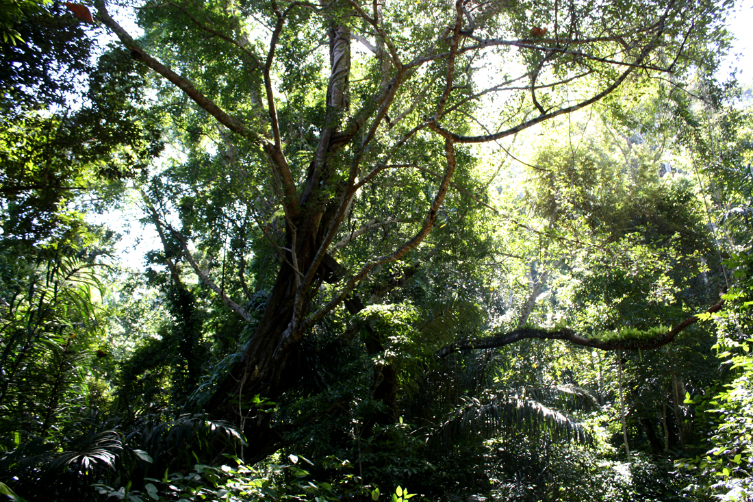
Mount Leuser National Park is one of the largest national parks in the world, containing over 800,000 hectares of virgin rainforest. The park is home to orangutans, gibbons, monkeys, elephants, tigers, and among the last of the Sumatran rhinoceros. There are research facilities for the study of primates, birds and insects, the Orangutans rehabilitation center at Bukit Lawang being the most popular with tourists. It is possible to raft Alas River from Ketambe to the Indian Ocean on a 4 - 5 day expedition. The journey takes us through exciting white-water rapids to the calmer, crocodile-infested waters of the lowlands. Basic accommodation is available at Ketambe. 

The Leuser National Park of Gunung Leuser is probably the wildest in Indonesia, located in Southeast Aceh, can be reached from either Kutacane, or Takengon. This magnificent national park has a wealth of flora and fauna. The Leuser Ecosystem is an outstanding wilderness in Aceh northern Sumatra. It is one of the richest expanses of tropical rain forest in Southeast Asia. More than 2.5 million hectares in size, it is the last place on earth where elephants, rhinos, tigers, clouded leopards, and orangutans are found within one area.

The first official statement of intent to protect the Leuser Ecosystem was signed in 1934. The Leuser International Foundation (a non-profit non-government organization) was established in the late 1990's when the ecosystem was seriously under threat from illegal logging and wildlife poaching.

Geographically, the Leuser Ecosystem lies between 3-4.5° North and 96.5-98° East. It covers approximately 2.6 million hectares of tropical rain forest, encompassing 890,000 hectares of designated national park, as well as extensive areas of protection and production forests. The ecosystem contains two major volcanoes, three lakes, and nine major river systems that flow to the east and west coasts of the island. 

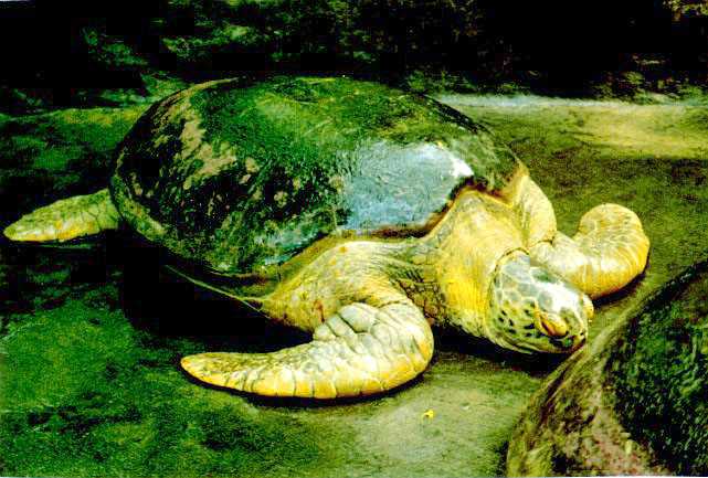
The Leuser Ecosystem has an enormous level of biodiversity. It contains at least 127 mammal species, including the Sumatran elephant, Sumatran tiger, Sumatran rhinoceros, and Sumatran orangutan. About 8,500 different plant species grow in the beach, swamp, lowland, mountain and alpine ecosystems of the Leuser Ecosystem. Of the 10,000 plant species recorded in the West Indo-Malayan Region, 45% are found in the Leuser Ecosystem. Spectacular plants such as Rafflesia (the largest flower in the world) and Amorphophallus (the tallest flower in the world) are among the plants protected there.


Mount Leuser National Park is one of the biggest national parks in Indonesia (950,000 hectare). Actually, it's a collection of various nature reserves and forests: Nature Reserve Mount Leuser, Nature Reserve Kappi, Nature Reserve Kluet, Sikundur Langkat Wildlife Reserve, Ketambe Research Station, Singkil Barat and Dolok Sembilin. Most parts of the national park lie in the region Aceh Tenggara (SE Aceh). Other parts are situated in the region east Aceh, south Aceh, and Langkat.

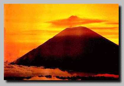
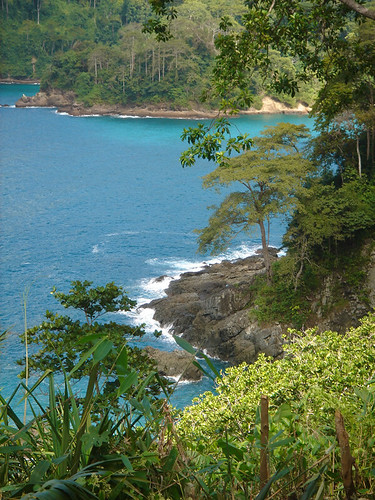
Mount Leuser National Park comprises more than 100 kilometers of the Bukit Barisan Mountains. Because of that, the park consists of steep, almost inaccessible mountainous terrain. The altitude ranges from 0 meter, in Kluet (South Aceh), to 3,381 meter, on top of the mount Leuser (Southeast Aceh). The Alas River cuts the park into an eastern and western half. Apart from mountains we find several other ecosystems: beach forest, swamp areas, lowland rainforest, alpine and mountain forest. In Bukit Lawang is the Orang Utan Rehabilitation Station and in Ketambe stands the Ketambe research station.[source : Gunung Leuser]

See The Beauty


Thursday, November 4, 2010

Mount Merapi

Mount Merapi, Gunung Merapi (literally Mountain of Fire in Indonesian/Javanese), is a conical volcano located on the border between Central Java and Yogyakarta, Indonesia. It is the most active volcano in Indonesia and has erupted regularly since 1548. It is very close to the city of Yogyakarta, and thousands of people live on the flanks of the volcano, with villages as high as 1700 m above sea level.

Merapi volcano is one of the world's most active and dangerous volcanoes. It contains an active lava dome, which regularly produces pyroclastic flows. It has been active for 10,000 years. This fire mountain remains one of the most active and dangerous volcanoes in the world. It can be seen from its name; Merapi from Javanese word 'Meru' means 'Mountain' and 'Api' means 'fire'. The internally giant smoking Mount Merapi is one of the active volcanoes that found in Indonesia. It is presenting its peaceful and sleepy dense forest.

Beyond this, there lies a vast deserted land with its deep and steep valley spread out among the mountain hills where sibilant pines and wild grass make out the dominating vegetation, all presents a very exciting panorama. Merapi is located about 30 km north of Yogyakarta, a city with a population of 500,000. It is tall (2.8 km or 1.7 miles high) and has steep slopes. The top of the volcano sometimes has a normal crater, but usually a broad mound of pasty lava (called a dome) fills the crater. The dome plugs up the volcano, making it difficult for other lava and ash to escape. A broad gouge funnels lava and ash flows from the top of Merapi to the south slopes of the volcano. [source : Merapi]

See The Dangerous Beauty


Monday, July 26, 2010

Mount Semeru

Semeru, or Mount Semeru (Indonesian: Gunung Semeru), is a volcano located in East Java, Indonesia. It is the highest mountain on the island of Java. The stratovolcano is also known as Mahameru, meaning 'The Great Mountain. Maars containing crater lakes have formed along a line through the summit of the volcano. It was formed south of the overlapping Ajek-ajek and Jambagan calderas. Semeru lies at the south end of the Tengger Volcanic Complex.
 
Semeru's eruptive history is extensive. Since 1818, at least 55 eruptions have been recorded (10 of which resulted in fatalities) consisting of both lava flows and pyroclastic flows. All historical eruptions have had a VEI of 2 or 3.

Semeru has been in a state of near-constant eruption from 1967 to the present. At times, small eruptions happen every 20 minutes or so.


Semeru is regularly climbed by tourists, usually starting from the village of Ranu Pane to the north, but though non-technical it can be dangerous. Soe Hok Gie, an Indonesian political activist of the 1960s died in 1969 from inhaling poisonous gases while hiking on Mount Semeru. [source : Semeru]

See The Beauty
 

Tuesday, May 25, 2010

Meru Betiri National Park

Meru Betiri National Park is a national park in the province of East Java, Indonesia, extending over an area of 580 km² of which a small part is marine (8.45 km²). The beaches of the park provide nesting ground for the endangered Leatherback turtles, Hawksbill turtles, Green turtles, and Olive Ridley turtles.

Meru Betiri National Park has a varied topography reaching from a plain coast to highlands with an altitude of almost 1,200 meters. The tallest mountains within the park are Mount Gamping (538 m), Mount Butak (609 m), Mount Sukamade Atas (801 m), Mount Gendong (840 m asl), Mount Mandilis (844 m) and Mount Betiri (1,192 m). The topography along the coast is generally hilly to mountainous. There are only few sandy plain coasts, most of them located in the west, such as Rajegwesi Beach, Sukamade Beach, Permisan Beach, Meru Beach and Bandealit Beach. Some rivers across Meru Betiri NP are Sukamade River, a perennial river, Permisan River, Meru River and Sekar Pisang River that flow to the South coast.

This national park is the habitat of rare plants, namely the interest Raflesia (Rafflesia zollingeriana), and several other types of plants such as Mangroves (Rhizophora sp.), Fire-fire (Avicennia sp.) Waru (Hibiscus tiliaceus), Nyamplung (Calophyllum inophyllum), Rengas (Gluta renghas), Bungur (Lagerstroemia speciosa), Pulai (Alstonia scholaris), Bendo (Artocarpus elasticus), and several species of plant medicines.

In addition, the Meru Betiri National Park have the potential to protected wildlife which consists of 29 species of mammals, and 180 species of birds. They are neat animals (Bos javanicus javanicus), long-tailed monkey (Macaca fascicularis), spotted tiger (Panthera pardus weld), ajag (Cuon alpinus javanicus), wildcat (Prionailurus bengalensis javanensis), deer (Cervus timorensis russa), flying squirrel red-tail (Iomys horsfieldii), peacock (Pavo muticus), starfruit turtles (Dermochelys coriacea), turtle shell (Eretmochelys imbricata), the green turtle (Chelonia mydas), and turtle ridel / fission (Lepidochelys olivacea). 

Meru Betiri National Park known as a habitat for Javanese Tigers (Panthera Tigris sondaica) a rare and protected. Until now, these animals never be found again and is estimated to have been extinct. Extinction of tigers loreng Java means extinction of three species of tigers from eight species in the world (in Iran's Caspian tiger, Bali tiger and Javan tiger in Indonesia).

Some interesting locations to be visited in Meru Betiri among other Rajegwesi Beach. At the beach, you can do nautical tourism, swimming, observation of plants or animals and cultural tourism (traditional fishermen). In the meadow Sumbersari, can be seen various animals such as sambar, deer, deer. Sukamade beaches suitable for camping activities, wind surfing, and observation of flora and fauna, particularly the activities that are laying turtles. The forest exploration, nautical tourism, and swimming can be done in Green Bay. 

The Meru Betiri area is influenced by monsoon wind. During November to March, the westerly wind brings rainfall to the area, whereas the dry season occurs during April to October. The average annual rainfall is between 2,300 and 4,000 mm, with 4 dry months and 7 wet months in average. And the best season  for visits this beuatiful place is among February to July each year.


See The Beauty


Friday, May 21, 2010

Mount Rinjani

Mount Rinjani or Gunung Rinjani is an active volcano in Indonesia on the island of Lombok West Nusa Tenggara (NTB). It rises to 3,726 metres (12,224 ft), making it the second highest volcano in Indonesia, and similar in height to Mount Fuji.

The first historical eruption occurred in September 1847. The most recent eruption of Mount Rinjani was in May 2010 and the most recent significant eruptions occurred during a spate of activity from 1994 to 1995 which resulted in the further development of Gunung Barujari. (G.Baru). Historical eruptions at Rinjani dating back to 1847 have been restricted to Barujari cone and the Rombongan dome (in 1944) and consist of moderate explosive activity and occasional lava flows that have entered Segara Anak lake. The eruptive history of Rinjani prior to 1847 is not available as the island of Lombok is in a location that remained very remote to the record keeping of the era.

The 6 km by 8.5 km oval-shaped caldera is filled partially by the crater lake known as Segara Anak ('Child of the Sea') This lake is approximately 2000 metres above sea level and estimated at being around 200 metres deep; the caldera also contains hot springs.

The Rinjani caldera forming eruption is thought to have occurred in the 13th century. Eruption rate, eruption sites, eruptiion type and magma composition have changed during the last 10,000 years before the caldera forming eruption. The eruptions of 1994 and 1995 have presented at Gunung Baru (or 'New Mountain' - approximately 2300 metres above sea level) in the center of this caldera and lava flows from subsequent eruptions have entered the lake. This cone has since been renamed Mount Barujari (or 'New Finger Mountain').

The highlands are forest clad and mostly undeveloped. The lowlands are highly cultivated. Rice, soybeans, coffee, tobacco, cotton, cinnamon, cacao, cloves, cassava, corn, coconuts, copra, bananas and vanilla are the major crops grown in the fertile soils of the island. The slopes are populated by the indigenous Sasak population. There are also some basic tourist related activities established on Rinjani primarily in or about the village of Senaru.

The volcano and the caldera are protected by the Gunung Rinjani National Park established in 1997. Tourism is increasingly popular with trekkers able to visit the rim, make their way into the caldera or even to make the more arduous climb to the highest point; fatalities, however, are not uncommon. In July 2009 the summit route was closed due to volcanic activity at that time and subsequently reopened when the activity decreased.

The lower and mid levels of the mountain are quite heavily forested. Above the tree line though the slopes are barren and rugged scree slopes and volcanic rock. The views of the crater lake are quite breath-taking from the caldera rim, as is the sunrise. From the absolute peak you can see Bali to the west and Sumbawa to the east.

The lower and middle elevation slopes are densely forested with typical tropical species. Fig trees are especially apparent. Casuarina forest (cemara) takes over higher up and eventually these give way to an alpine flora above the treeline.

Lombok is east of the Wallacean Line and some Australian bird species are therefore apparent. These include a lot of Sulphur Crested Cockatoos and Green Hanging Parrots. Bird life is generally not easy to observe here though due to the density of the forest.

The familiar long-tailed grey macaque (the Bali temple monkey!) is common right up to the crater rim. Of much more interest is the rare ebony leaf monkey which inhabits these forests. Rusa deer and muntjacs are more often heard than seen.

Rinjani is best climbed during the April-November dry season. It is possible to climb during the rainy season as well but treks are often cancelled at short notice if the rain is heavy. It gets very cold on the mountain above 2,000 metres and nears freezing at the summit. Warm clothing is an absolute must.


See The Beauty

  Smokin' Sapphire

 Golden Sky

Down The Hill

Rinjani's Sunrise

Thursday, May 20, 2010

Mount Tambora

Mount Tambora (or Tamboro) is an active stratovolcano, also known as a composite volcano, on the island of Sumbawa, Indonesia. Sumbawa is flanked both to the north and south by oceanic crust, and Tambora was formed by the active subduction zone beneath it. This raised Mount Tambora as high as 4,300 m (14,100 ft), making it formerly one of the tallest peaks in the Indonesian archipelago. After a large magma chamber inside the mountain filled over the course of several decades, volcanic activity reached a historic climax in the super-colossal eruption of April 1815.

The 1815 eruption is rated 7 on the Volcanic Explosivity Index, the only such eruption since the Lake Taupo eruption in about 180 AD. With an estimated ejecta volume of 160 cubic kilometers, Tambora's 1815 outburst was the largest volcanic eruption in recorded history. The explosion was heard on Sumatra island (more than 2,000 km (1,200 mi) away). Heavy volcanic ash falls were observed as far away as Borneo, Sulawesi, Java and Maluku islands. Most deaths from the eruption were from starvation and disease, as the eruptive fallout ruined agricultural productivity in the local region. The death toll was at least 71,000 people (the most deadly eruption in recorded history), of whom 11,000–12,000 were killed directly by the eruption; the often-cited figure of 92,000 people killed is believed to be overestimated. The eruption created global climate anomalies that included the phenomenon known as "volcanic winter": 1816 became known as the "Year Without a Summer" because of the effect on North American and European weather. Agricultural crops failed and livestock died in much of the Northern Hemisphere, resulting in the worst famine of the 19th century.

During an excavation in 2004, a team of archaeologists discovered cultural remains buried by the 1815 eruption. They were kept intact beneath the 3 m (9.8 ft) deep pyroclastic deposits. At the site, dubbed the Pompeii of the East, the artifacts were preserved in the positions they had occupied in 1815.

This is a difficult mountain to reach let alone climb. Few non-Indonesian visitors ever make it to this remote corner of northern Sumbawa and far fewer still to the top of mighty Mount Tambora. 
 
It is possible to climb Tambora but be warned - it is not a stroll in the park. You have to be physically very fit and be ready for some discomfort and danger. Very few Indonesians, and far fewer foreigners, ever make it to this out of the way place. Since 2004 when records began to be kept by K-PATA - Kelompok Pencinta Alam Tambora (The Tambora Nature Lovers Group), only about 50 people per year have made the trip. For example in the first six months of 2009 only three groups climbed the mountain -a group of nine Indonesians, a Frenchman and one Australian.

To reach Tambora you need to get to the village of Pancasila. It is problematic if you want to do this in one day from Sumbawa Besar. If you want to try, take the Sumbawa Besar/Dompu bus very early in the morning and tell the driver you want to go to Calabai/Pancasila Mau mendaki Tambora (I want to climb Tambora). He will drop you after four to five hours at the tee-intersection from where the road to the right goes to Dompu (about 20 km away) and the road to the left takes you to Calabai. There are regular buses to Calabai but the road is very bad and the 110 km trip takes 4-5 hours. From Calabai you have to take an ojek (back of a motorcycle) to Pancasila.

At Pancasila you will be directed to K-Pata's headquarters. The manager is Saiful and his wife is Irma. They will give you a room to stay, feed you well and organise guides. A fair price for food and lodging is Rp 100,000 per night and the guides require Rp 200,000 per day. This is a very reasonable fee considering the amount of work they are required to do on the trip, the nature of the terrain and the length of the walk.

The walk is through virgin jungle. It is incredibly thick in parts and a lot of parang work is required. You will walk for hours along an almost indecipherable trail. 

for further details visit http://wikitravel.org/en/Mount_Tambora

See The Beauty


Monday, May 17, 2010

Mount Bromo


Mount Bromo (Indonesian: Gunung Bromo), is an active volcano and part of the Tengger massif, in East Java, Indonesia. At 2,329 metres (7,641 ft) it is not the highest peak of the massif, but is the most well known. The massif area is one of the most visited tourist attractions in East Java, Indonesia. The volcano belongs to the Bromo Tengger Semeru National Park.

Mount Bromo sits in the middle of a vast plain called the Sand Sea (Indonesian: Lautan Pasir), a protected nature reserve since 1919. The typical way to visit Mount Bromo is from the nearby mountain village of Cemoro Lawang. From there it is possible to walk to the volcano in about 45 minutes, but it is also possible to take an organised jeep tour, which includes a stop at the viewpoint on Mount Penanjakan (2,270 meters) (Indonesian: Gunung Penanjakan). The best views from Mount Bromo to the Sand Sea below and the surrounding volcanoes are at sunrise. The viewpoint on Mount Penanjakan can also be reached on foot in about two hours. From inside the caldera, sulfur is collected by workers.

If a landscape was ever needed to demonstrate the meaning of the phrase desolate beauty, then this is surely it. Rugged, barren volcanic peaks, gravel plains and that sea of sand. Truly unworldly. And the best natural attractive of Bromo is watching sunrise surround its caldera. It is a stunning moment.

The park also includes large areas which are very lush and green fed by rivers from the high tops. The medium elevations are clad with much thinner forest before this gives way to the barren plateau and peaks.

It's other attractiveness, is that volcano is a place of a final ritual ceremony called kasada of Tengger Tribe that is reprensented by throwing farming product like fruits and grain onto Mount Bromo crater. This annual ceremony has always attract tourists to see it.

source : http://en.wikipedia.org/wiki/Mount_Bromo

See The Beauty 

 Smoke on The Blue Sky

 Waiting The Moment

Climb The Stairs

Across The Sand Sea