Showing posts with label Bali. Show all posts

Wednesday, November 10, 2010

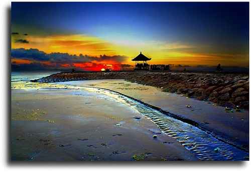
Nusa Dua Beach

Nusa Dua Beach is located approximately 40 km south of Denpasar, the provincial capital of Bali.

The place name Nusa Dua can be used in two ways: either it can refer to the entire eastern side of the Bukit Peninsula at the southern tip of Bali, or it can refer to the purpose-built, safe and rather sterile tourist enclave (Kawasan Pariwisata, quite literally Tourism District) at the southeast side of this peninsula. 

This article covers everything in the Nusa Dua enclave plus the Tanjung Benoa peninsula and a few points west of the enclave to the village of Sawangan. Everything on the Bukit Penisula to the west of Sawangan is covered by the Uluwatu article. 

As well as a host of luxury hotels, Nusa Dua is home to the most popular golf course in Bali and the main convention centre on the island. 

Nusa Dua understandably gets a lot of bad press amongst travelers as it is so artificial and sanitised. That does not change the fact though that the beaches here are glorious - white sand, deep, long and safe for swimming. The public beach at Geger is the best to head to if you are not staying at Nusa Dua. This is also home to one of the best museums in Bali. The fact that it is nearly always empty is testament that most visitors who stay here in the least Balinese part of the island are, not unsurprisingly, rather disinterested in learning much about Bali. 

The Nusa Dua enclave has three manned gates and everyone entering is subject to a security search. This can have a slightly claustrophobic effect, and only contributes further to the impression that you are in an artificial location. [source : Nusa Dua]

See The Beauty


Monday, July 5, 2010

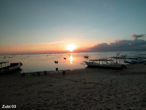
Nusa Lembongan

Nusa Lembongan is a small island off the southeast coast of the main island of Bali. Fast becoming one of Bali's most popular attractions, this island paradise is a world away from the hassle and hectic pace of South Bali. Neither hawkers nor traffic mar the magnificent scenery; this is a fine place to just put your feet up and relax. Main activities include surfing, diving and snorkeling. The water is some of the clearest you will find anywhere, and a vivid aqua blue in colour. 

Nusa Lembongan is approximately eight square kilometres in size, and is one of three neighbouring islands, the others being much larger Nusa Penida and tiny Nusa Ceningan. The three islands are separated from Bali by the Badung Strait. Some visitors may find Nusa Lembongan a little slow after the pace of South Bali. 

Many areas around the island are good for diving and snorkeling, with abundant marine life and healthly coral. Surfing can get a bit crowded, but the waves are good. There are several white sand beaches away from the main centres which are virtually never crowded. There is a flourishing and well established seaweed farming industry here, and many visitors find it interesting to learn about this. 

Two main beach areas have traditionally attracted visitors. Jungut Batu in the northwest is the bigger of the two, and has myriad hotels and cheap eateries. This is the area which traditionally attracted backpackers and surfers to the island. The white sand beach here is pleasant enough but nothing to get too excited about, and it is a little narrow in places. In more recent times, the hillside to the south of Jungut Batu known as the Bukit (the hill) has been developed and has attracted higher level hotels. The views from the Bukit are perhaps second to none on Nusa Lembongan. Sunsets are best viewed along the main Jungut Batu beachfront. 

Mushroom Bay to the southwest of Jungut Batu is a quaint, attractive and sheltered bay. It is an especially nice spot after 3PM when the day trippers have returned to Bali, and it has a great white sandy beach, along with some cozy little water-side restaurants. 

Further south, the lesser known beaches either side of the Devil's Tear outcrop, known as Dream Beach and Sunset Beach, are increasingly drawing more visitors. The coastal landscape in this part of the island is mostly low-lying limestone cliffs, and there are some dramatic cave formations. 

The north end of the island is fringed by a mangrove forest, and the eastern side of the island is separated from neighbouring Nusa Ceningan by a shallow estuarine channel. 

The main population centre of the island is Lembongan Village in the southern interior, and it is here that you will find the homes of most traditional island families.[source : Nusa Lembongan]

See The Beauty


Friday, May 14, 2010

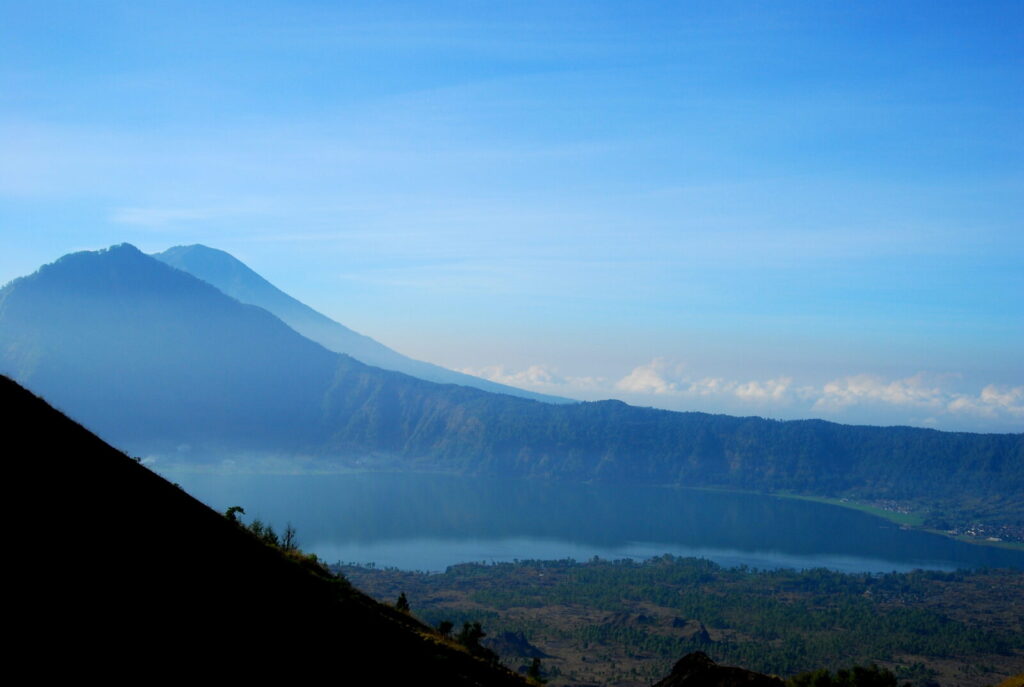
Mount and Lake Batur

Mount Batur (Gunung Batur) is an active volcano located at the center of two concentric calderas north west of Mount Agung, Bali, Indonesia. The south east side of the larger 10×13 km caldera contains a caldera lake. The inner 7.5-kilometer-wide caldera, which was formed during emplacement of the Bali (or Ubud) ignimbrite, has been dated at about 23,670 and 28,500 years ago.

The SE wall of the inner caldera lies beneath Lake Batur; Batur cone has been constructed within the inner caldera to a height above the outer caldera rim. The Batur stratovolcano has produced vents over much of the inner caldera, but a NE-SW fissure system has localized the Batur I, II, and III craters along the summit ridge. Historical eruptions have been characterized by mild-to-moderate explosive activity sometimes accompanied by lava emission. Basaltic lava flows from both summit and flank vents have reached the caldera floor and the shores of Lake Batur in historical time. The caldera contains an active, 700-metre-tall stratovolcano rising above the surface of Lake Batur. The first historically documented eruption of Batur was in 1804, and it has been frequently active since then.

The caldera is populated and includes the two main villages of Kedisan and Toya Bungkah. The locals largely rely on agriculture for income but tourism has become increasingly popular due to the relatively straightforward trek to the summit of the central crater.

The mountainous region around Kintamani, centering on the spectacular volcanic caldera of Mount Batur with its deep crater lake and bubbling hot springs, is rugged with a high and wild beauty.

Wonderful mountain air and dizzying views in all directions, as well as several important temples, are what makes Kintamani one of the most memorable stops on the Bali tourist itinerary.

The lake, Danau Batur, is the largest crater lake on the island of Bali and is a good source of fish. 

As the road rises steadily from Bangli or Tampaksiring, nothing in the surrounding grey landscape of bushes and garden plots suggest the presence of a volcano. But over, one more small ridge a dizzying view awaits the eyes, encompassing the crater and beyond. From Penelokan, the main road runs right round the rim towards Kintamani, the panorama shifting as circling around the crater.

See The Beauty
Blue Mountain

 Sunrise Over The Lake

 Over The Clouds

Thursday, May 13, 2010

Kuta Beach

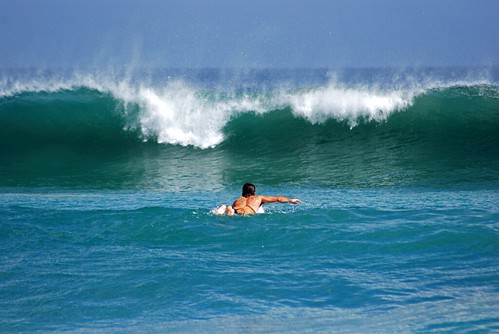
Kuta is administratively a district (kecamatan) and subdistrict/village (kelurahan) in southern Bali, Indonesia. A former fishing village, it was one of the first towns on Bali to see substantial tourist development, and as a beach resort remains one of Indonesia's major tourist destinations. It is known internationally for its long sandy beach, varied accommodation, many restaurants and bars, and many renowned surfers who visit from Australia. It is located near Bali's Ngurah Rai Airport.

Kuta was the site of the October 12, 2002 1st Bali bombing (202 killed) and the October 1, 2005 2nd Bali bombing (26 killed).

The Balinese Provincial Government have taken the view that the preservation of the Balinese culture, natural resources and wildlife are of primary importance in the development of the island. To this end they have limited tourist development to the peninsula on the extreme southern aspect of the island; Kuta beach is on the western side of this peninsula and Sanur is on the east. To the north of the peninsula no new tourist development is supposedly permitted.

To the south, Kuta Beach extends beyond the airport into Jimbaran. Other nearby towns and villages include Seseh (6.4 nm), Denpasar (4.5 nm), Ujung (1.8 nm), Pesanggaran (2.0 nm), Kedunganan (2.9 nm) and Tuban (1.0 nm).

Kuta is now the center of an extensive tourist-oriented urban area that merges into the neighboring towns. Legian, to the north, is the commercial hub of Kuta and the site of many restaurants and entertainment spots. Most of the area's big beachfront hotels are in the southern section of Tuban.

Legian and Seminyak are northern extensions of Kuta along Jl. Legian and Jl. Basangkasa. They are somewhat quieter suburbs with cottage-style accommodations, where many of the expat crowd live. Also to the north are Petitenget, Berawa, Canggu, and Seseh - new and quieter continuations of Kuta's beach. They are easy to reach through Abian Timbul or Denpasar and Kerobokan. Several large hotels are located in this area: the Oberoi Bali, Hard Rock Hotel Bali, the Intan Bali Village, the Legian in Petitenget, the Dewata Beach and the Bali Sani Suites in Berawa.

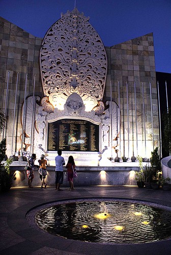
1st Bali Bombing in 2002 at Kuta: A permanent memorial was built on the site of the destroyed Paddy's Pub on Legian Street. (A new bar, named "Paddy's: Reloaded", was reopened further along Legian Street). The memorial is made of intricately carved stone, set with a large marble plaque, which bears the names and nationalities of each of those killed. It is flanked by the national flags of the victims. The monument is well-maintained and illuminated at night.


In line with the return of tourism to Kuta, Kuta Karnival has grown into a tourism promotional event with major coverage from television and newspapers from across the globe. Companies, embassies, Non-Government Organizations, associations and even individuals come forth to get involved in the various events such as a Balinese dance competition presented by a surf-wear company, an environment exhibition presented by an embassy, a fun cycle presented by a group of individuals, a seminar presented by an association and a parade on the streets presented by an NGO. Tourists and locals alike, more than ninety thousand people participates in the numerous events, year after year.

A repeated tragedy in Bali in 2005 did not reduce the Kuta community’s determination to carry out this annual event. Kuta Karnival is conducted to commemorate and give respect to the victims of human violence and show the world the true spirit of local community survival despite terrorism attacks.


See The Beauty

Smooth

A Warm Sunset

Catch The Wave

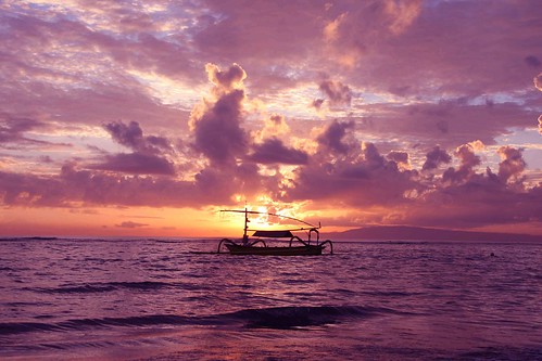
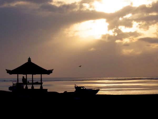
Sanur Beach

Sanur (Indonesian:Pantai Sanur Pronounced Sah-Noor) is a coastal stretch of beach of Denpasar city of south east Bali, about 30 minutes drive from Ngurah Rai International Airport, which has grown into a little town in its own right.

The northern part of Sanur beach was used as the landing site for the Dutch invasion troops during the Dutch intervention in Bali (1906).

During World War II, Sanur was again the entry point through which the Japanese forces landed to occupy the island of Bali.

Today Sanur contains a number of resorts such as the Medina and Bali Hyatt (not to be confused with the Grand Hyatt in Nusa Dua) and is a popular tourist destination.

Sanur is one of Bali's biggest traditional villages but it's also one of the most established tourist areas. Fine hotels, restaurants and modern entertainment venues compliment traditional village activities like drama and dance, so it's a good place to enjoy the delights of a tropical island and gain a real appreciation of Balinese culture and local life.

             http://www.bali-indonesia.com/sanur/


See The Beauty
Lay on Beauty

Purple Sky

Silhoutte

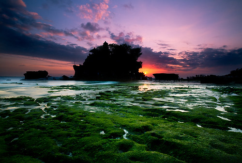
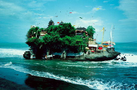
Tanah Lot : Land in the Sea

Tanah Lot means "Land [sic: in the] Sea" in Balinese language Located in Tabanan, about 20 km from Denpasar, precisely in countryside of Beraban, district of Kediri, sub-province of Tabanan. The temple sits on a large offshore rock which has been shaped continuously over the years by the ocean tide.

Tanah Lot is claimed to be the work of the 15th century priest Nirartha. During his travels along the south coast he saw the rock-island's beautiful setting and rested there. Some fishermen saw him, and bought him gifts. Nirartha then spent the night on the little island. Later he spoke to the fishermen and told them to build a shrine on the rock for he felt it to be a holy place to worship the Balinese sea gods.

The Tanah Lot temple was built and has been a part of Balinese mythology for centuries. The temple is one of seven sea temples around the Balinese coast. Each of the sea temples were established within eyesight of the next to form a chain along the south-western coast.

At the base of the rocky island, poisonous sea snakes are believed to guard the temple from evil spirits and intruders. A giant snake purportedly protects the temple, which was created from Nirata’s scarf when he established the island.

             http://www.tanahlot.net

See The Beauty
  Getting Drown

 Ceremony

 Land in the Sea

Sunset at Tanah Lot

Tuesday, May 11, 2010

Bali : The Island of Gods

Bali is an Indonesian island located at Coordinates: 8°25′23″S 115°14′55″E / 8.42306°S 115.24861°E / -8.42306; 115.24861 the westernmost of the Lesser Sunda Islands, lying between Java to the west and Lombok to the east. It is one of the country's 33 provinces with the provincial capital at Denpasar towards the south of the island.

With a population recorded as 3,551,000 in 2009, the island is home to the vast majority of Indonesia's small Hindu minority. About 93.18% of Bali's population adheres to Balinese Hinduism, while most of the remainder follow Islam. It is also the largest tourist destination in the country and is renowned for its highly developed arts, including dance, sculpture, painting, leather, metalworking and music.

The island of Bali lies 3.2 km (2 mi) east of Java, and is approximately 8 degrees south of the equator. Bali and Java are separated by Bali Strait. East to west, the island is approximately 153 km (95 mi) wide and spans approximately 112 km (69 mi) north to south; its land area is 5,632 km².

The highest point is Mount Agung at 3,142 m (9,426 feet) high, an active volcano that last erupted in March 1963. Mountains range from centre to the eastern side, with Mount Agung the easternmost peak. Mount Batur (1,717 m) is also still active; an eruption 30,000 years ago was one of the largest known volcanic events on Earth.[citation needed] In the south the land descends to form an alluvial plain, watered by shallow, north-south flowing rivers, drier in the dry season and overflowing during periods of heavy rain. The longest of these rivers, Ayung River, flows approximately 75 km.

The island is surrounded by coral reefs. Beaches in the south tend to have white sand while those in the north and west have black sand. The beach town of Padangbai in the south east has both. Bali has no major waterways, although the Ho River is navigable by small sampan boats. Black sand beaches between Pasut and Klatingdukuh are being developed for tourism, but apart from the seaside temple of Tanah Lot, they are not yet used for significant tourism.

The largest city is the provincial capital, Denpasar, near the southern coast. Its population is around 300,000. Bali's second-largest city is the old colonial capital, Singaraja, which is located on the north coast and is home to around 100,000 people. Other important cities include the beach resort, Kuta, which is practically part of Denpasar's urban area; and Ubud, which is north of Denpasar, and is known as the island's cultural centre.


Three small islands lie to the immediate south east and all are administratively part of the Klungkung regency of Bali: Nusa Penida, Nusa Lembongan and Nusa Ceningan. These islands are separated from Bali by the Badung Strait.

To the east, the Lombok Strait separates Bali from Lombok and marks the biogeographical division between the fauna of the Indomalayan ecozone and the distinctly different fauna of Australasia. The transition is known as the Wallace Line, named after Alfred Russel Wallace, who first proposed a transition zone between these two major biomes. When sea levels dropped during the Pleistocene ice age, Bali was connected to Java and Sumatra and to the mainland of Asia and shared the Asian fauna, but the deep water of the Lombok Strait continued to keep Lombok and the Lesser Sunda archipelago isolated.


source : http://en.wikipedia.org/wiki/Bali